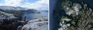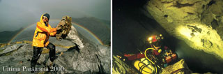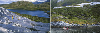

After many successful expeditions to Chilean Patagonia, ‘Centre Terre’ is once again embarking on a major adventure, this time, on the other side of the Pacific. New Britain island in Papua New Guinea is where it will take place. In the caving circles, this island has become legendary for the commitment it requires and, above all, for the vast size of its karst networks. In fact, it was in the Nakanai mountains - where we'll be heading - that previous French expeditions explored the Muruk cave system, the first minus 1000 metre deep network and, to this day, the deepest in the southern hemisphere.
Our expedition’s goal will be to find the presumed Mayang mega-collector, whose estimated flow of 20 to 30 m³/s at low water makes it one of the largest karst resurgences in the world. Despite multiple significant caving expeditions, its underground path is still unknown.
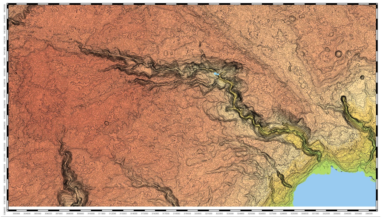
We will be exploring its presumed catchment area, a vast zone still untouched by any speleological exploration. The reason why an area with such potential remains unexplored to this day is its exceptional difficulty of access.
‘Centre Terre’s strength lies in its ability to deploy significant logistical means and a strong multi-disciplinary team to explore the most remote corners of the planet and deal with unique phenomena. As usual, science will play a key role in our objectives, including caving - “a sport at the service of science”, according to Norbert Casteret - as almost everything remains unknown, and very few scientists have been able to access the heart of the dense forest of the Nakanai Mountains.
‘Centre Terre’ scientists, either on-site, or involved in the preparations and the post-expedition processing in their labs in France, have already identified a variety of lines of research, listed below by scientific field. As the team is not yet totally set, these lines of research may evolve.
The stakes of such studies could be major and numerous, on the one hand, it will provide useful data for science on a region that despite being little known due to its inaccessibility, is one of the world's biodiversity hotspots. On the other hand, the scientific results of the Mayang 2026 expedition could bring a crucial and decisive contribution to a UNESCO World Heritage nomination. In fact, following the results of previous speleological and scientific expeditions, the Nakanai Mountains were identified by the Papuan State as a serial natural site and were included in 2006 on the UNESCO Tentative List under the name “The Sublime Karsts of Papua New Guinea”.
The cartographic data currently available do not offer sufficient precision to be of significant help in our explorations. A great deal of preliminary work is already underway to obtain the best satellite images of the area and process them to produce a base map of unprecedented accuracy. The work in progress is already a powerful tool for the needs of our expedition and has enabled us to better target our exploration area. It will be enhanced by the acquisition of new data and our observations in the field.
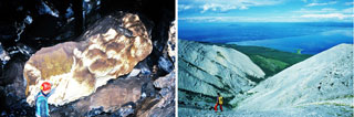
Pure, loosely-compact limestone formed 15 million years ago (Miocene limestone AKA Yalam limestone), one of the highest rainfall rates on the planet, dense vegetation cover and high seismicity: the Nakanai Mountains combine all the superlatives and ingredients for outstanding karstification, resulting in highly chaotic surface landscapes (“polygonal karst”) and giant caves with underground mega-rivers.
The main objective of our expedition is to reach the collector of the Mayang mega-resurgence, one of the largest in the world: its flow has been estimated at 20 m³/s at low water, and probably over 100 m³/s during floods. One of the factors behind this phenomenon is, of course, heavy rainfall. Meteorological data is available only for the coast, and precipitation levels increase sharply the higher you go in the mountains. During the “Nakanaï 98” expedition, Philippe Audra measured rainfall at Muruk over a one-month period and estimated annual precipitation at almost 12,500 mm (Audra, 2001).
Our almost two-month presence on the massif will enable us to enhance these results by establishing a meteorological field station to measure rainfall, temperature, barometric pressure, and humidity. As we have already done successfully on Madre de Dios Island in Chilean Patagonia, we will be able to leave some of the equipment in place until the next expedition and thus acquire data year long.
Since we have chosen to focus on an area that has never been explored by cavers before, within the presumed Mayang catchment area, we are still unsure of the type of caves we will encounter and their flow rates. In any case, we will measure flows by gauging, and carrying out physicochemical analyses of the water. This data will be cross-referenced with precipitation data. We may also consider water tracing depending on the flows encountered.
As for the Mayang resurgence, first spotted by cavers in 1985, it is impenetrable, emerging from a massive chaos of blocks.
Depending on our means in the field, and on any water tracing that may have been put in place, we'll try to reach it to be able to estimate its flow more accurately, which represents a real metrological challenge.
Major cave systems in New Britain are formed mainly due to a combination of factors: on the one hand, the calcium carbonate purity of the Miocene Yalam limestones, which makes them highly soluble and reactive to chemical erosion by strong water flows; on the other, their rather soft and loose nature, due to their relative “youth”, which also makes them responsive to mechanical and gravity erosion (internal collapse). The region's strong seismicity could have taken advantage of this intrinsic instability, which is suspected in playing a major role in the formation of large volumes, based on the observations and experiences of previous expeditions. To quantify the role of seismicity in the formation of the massif's major underground networks, in situ observations will be carried out to find traces and evidence of paleo-earthquakes and their link to the formation of the conduits. Samples of speleothems (concretions) affected by these paleo-earthquakes may be collected to date the identified seismic event.
Despite the presence of the dense forest, the very chaotic karst geomorphology of the Nakanai Mountains are so hypertrophied (polygonal karst, very deep narrow canyons with very vertical walls), that it is quite clearly perceptible and observable in situ as well as on aerial and satellite images. A mapping of the terrain's shapes and forms is still to be carried out, and the area prospected on the surface during the expedition will provide new elements to the puzzle of geomorphological data already collected by previous expeditions in neighbouring areas at a little lower elevation.
Will we be able to observe traces and signs of a morpho-climatic gradation of karst features according to altitude, as shown most remarkably in the high-mountain karst of the Huon Peninsula on the New Guinea island?
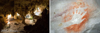
Caves are also landforms that provide information on the genesis and evolution of regional paleogeography. They are also windows into the bowels of the limestone layers, likely to reveal fossils unearthed by the dissolution of the limestone, such as the long whale bone discovered in 1995 still embedded in the wall of a passage in the Muruk chasm.
The abundant concretions in the caves of this forest karst are also precious records and archives of past climates and environments, and their evolution over millennia or even millions of years. Studies of concretions in equatorial regions are expanding rapidly, providing new insights into the evolution of precipitation patterns in relation to seasonal monsoon phenomena and multi-year El Niño-type cycles. Recent studies on the island of Borneo have demonstrated that paleotemperature reconstructions from speleothems over the very long term are reliable and can reflect southern hemisphere temperature variations as well as atmospheric CO2 concentrations (Loland et al. 2022). It would be interesting to compare these records with those from Papua New Guinea. However, before considering a sampling campaign, we need to be sure that the micro-climatic conditions in the cave where these samples will be taken are stable. In the spirit of conservation, we could start by monitoring conditions in a few caves using temperature sensor-recorders, and plan to collect dripping water in the cavity; this would complement the monitoring carried out on the surface using the weather station. It will help us verify the quality of the rainwater’s climatic signal transfer, which flows through the soil and then leaks into the rock, down to the cave and the formation of a concretion: an essential prerequisite for any paleoclimatic study.
Contributing to the assessment of a global biodiversity hotspot
Tropical forest habitats are characterized by exceptional biodiversity of global ecological importance. However, they are subject to a range of recently identified and quantified anthropogenic threats (White et al. 2021). Managing these threats is a necessary course of action in the face of the global challenge of biodiversity erosion, particularly in New Guinea, but it must be based primarily on knowledge of the environment and the species. In these particularly isolated mountains, inventorying plant and animal species is still a real challenge and remains largely incomplete. As our expedition takes place in a pristine area, it will also help fill this gap.
Due to the great difficulty of accessing the karsts of Papua New Guinea, their underground fauna has long remained widely unknown. The first studies date back to 1976 (Beron for New Ireland and Chapman for the Hindenburg Mountains of New Guinea). Despite their small numbers, collections made during previous speleological or scientific expeditions have revealed unique endemic terrestrial and aquatic forms, some with a very high degree of troglobiomorphy. Examples include the crab Trogloplax joliveti (Guinot 1986), collected in the Nakanai Mountains during the 1985 expedition, for which a subfamily had to be created; the Atyidae Jolivetya foresti (Cals 1986); and the terrestrial fauna Trogloclivina brehieri (Deuve 2003). In this context of scarcity of data and richness of biodiversity, the interest in collecting underground fauna is obvious, and the discoveries are more than likely.
Means used:
In the field, both terrestrial and aquatic fauna will be sampled, relying on cave diving for the latter. Simple techniques appropriate to the conditions of the expedition will be used: sight hunting, baited traps, plankton towed nets, nets at the resurgence, etc... For terrestrial fauna, comparative sampling of soil fauna will be carried out, including trapping and soil washing techniques. Sorting will be carried out on site under a binocular magnifying glass. Biological material will be preserved in ethanol.
Back in France, the samples will be further sorted and photographed before being sent to specialists in each group for identification and description.
Anticipated partnerships: MNHN Paris, MNHN Stuttgart, Pomio University.
Avifauna is a significant indicator of the ecological health of an ecosystem, a remarkable fauna, highly endemic to tropical and equatorial forests. Its inventory is therefore of great interest. The expedition is thus helping to measure the avifaunal diversity of the Nakanai Mountains and to compare it with databases from better-known tropical areas.
As forest wildlife is generally discreet and not very visible under the dense vegetation cover, it is by its sounds that it becomes more evident. Recording bird songs is therefore the most effective and widely used way of carrying out the most comprehensive avifauna inventories possible in forests. This scientific section is based on this process.
Means used:
We will install a device around the base camp(s). This will allow continuous audio and/or video recording of the environment throughout the expedition. The records will be supplemented by field observations and photographs. The data will be processed and analysed in the laboratory upon return from the expedition to identify the recorded species.
The settlement of Papua New Guinea dates back to ancient times. Genomic analyses of Melanesian populations have revealed that the first human migrations to Papua New Guinea occurred between 50,000 and 65,000 years ago, marking the arrival of the ancestors of Papuans and Australian Aboriginals on the supercontinent known as Sahul, which encompassed Papua New Guinea, Australia, and Tasmania.
Initially settled near the coast, the population then dispersed to the high plateaus and valleys, slowly colonising the interior. Several archaeological excavations on the main island have revealed the remains of these settlements. In the south of the island, in a particularly isolated valley in the Western Highlands province, the vast archaeological site of Kuk is known for its almost continuous indigenous agriculture dating back 7,000 or even 10,000 years. This site is now listed by UNESCO. Another site, to the south-west, has yielded the oldest remains on the island, dated to around 49,000 years ago (Ivane site).
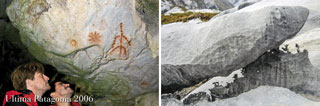
While many open-air sites have been extensively documented since the first digs in 1959, several cave and rock shelter sites have also been discovered and excavated. Examples include the Yuku rock shelter, in the Western Highlands province, excavated in 1959, the Niobe rock shelter (Chimbu), excavated in 1960, and the Aibura cave (Eastern Highlands), excavated in 1964. More recently, archaeologists have been studying the rock shelters at Manim (Jiwaka), excavated in 2019, and the cave complex at Eripe (Gulf), excavated in 2024. Some sites have preserved cave paintings, petroglyphs in the Walufeni cave (Southern Highlands), decorated shelters in the Sepik region, etc…
The Mayang 2026 team includes an archaeologist with over 25 years experience in preventive archaeology. In the event of the discovery of an archaeological site (cave, rock shelter or even an open-air site), we will take care to preserve the traces of any predecessors and to protect them if necessary. Visible remains will be described and mapped, and the sites topographed. The most detailed photographic coverage possible will be produced for conservation purposes (detail photographs, photogrammetry, etc.). No archaeological excavation will be undertaken and no object of archaeological or heritage value will be removed or moved.
Any discoveries will be brought to the attention of the inhabitants of the massif, who are the heirs of the ways of life and the former occupants of the high-altitude areas that have now been abandoned, revealing to them the local memory and knowledge. The local authorities will also be informed by the end of the expedition, or immediately if the discoveries justify it.
The Mayang 2026 expedition is a continuation of the French expeditions conducted in the area since 1978. This provides us with almost 50 years of hindsight into the evolution of the unique socio-ecosystem of the Papuan Nakanai forest, this ethnotope as well as biotope, are a privileged observatory of the evolution of the relationship between the first peoples and their environment, and the effects of their contact with the ‘world economy’, from the Australian presence to that of the Asian forestry companies, without neglecting the effects of the sporadic but recurring presence of scientific expeditions involving and interacting strongly with the local populations and social structures.
The relationship with the natural elements, especially the violent natural phenomena (cyclones, earthquakes, floods, volcanic eruptions), is a particularly interesting theme for investigation. The same applies to the intent of interviewing locals and officials about the management of the area's natural resources, starting with the vast forest, as well as the rivers’ water, which is a vital resource for the coastal villages located at the river mouths.
The expedition will also pay close attention to the impact of human activities on the elements of the ‘critical zone’ that make up the landscapes of the Nakanai primary forest and karst environments, above and below ground, biotic and abiotic: fauna-flora-fungi, soils, substrate, surface and groundwater, etc. The objective is to record and report these signs in an objective and scientifically usable way, while taking care to limit and avoid any impacts we may have on the environment in situ that could compromise its integrity. However, it should be emphasised that the footprint of an expedition of around twenty people spread over a vast area for less than 3 months, without a prolonged presence at a single point, acting consciously and responsibly according to particularly adapted logistical standards, is in no way comparable to that of large-scale operations. The logistical choices made, based on a light and temporary base and advanced camps, and on an airborne approach and drop-off that is less intrusive than a column of dozens of cavers and ‘porters’ cutting through the forest from the coast, demonstrate the desire to minimise impact that is so dear to ‘Centre Terre’ and the scientists involved. Even more so as we'll be operating in an environment with a high heritage value.
The observations and data collected by the expedition, drawn up in collaboration with the University and the WWF office in Pomio, structured according to current international standards for inventory of natural heritage (bio-heritage, geo-heritage), can be used both to assess and recognise the heritage values of the Nakanai and to draw up a conservation management plan for the massif while keeping sight of an eventual nomination of the ‘Sublime Karsts of Papua New Guinea’ to the World Heritage.
Pomio University Center – Palmalmal
WWF Pomio
Conservation Environment Protection Authority, Department of Lands and Physical Planning, East New Britain Provincial Administration,
ONG FORCERT (https://forcertpng.org/)
Papua New Guinea FlyingLabs (association de promotion de l’usage des drones pour développement local)
Papua New Guinea University of Natural Resources & Environment,
Pomio District Development Authority
UMR EDYTEM – Université Savoie Mont-Blanc
Muséum National d’Histoire Naturelle - Paris
Department of Entomology – Natural History Museum - Stuttgart
Laboratoire UMR 5602 GEODE – Université toulouse Jean-Jaurès
Université Claude bernard Lyon 1
Paleoclimate
Løland, M.H., Krüger, Y., Fernandez, A. et al. (2022). Evolution of tropical land temperature across the last glacial termination. Nat Commun 13: 5158. https://doi.org/10.1038/s41467-022-32712-3
Underground biology
Beron P. (1976). Preliminary notes for a biospelogical trip to New Ireland. Niugini caver 4-1 : 21-30.
Cals P. (1986). Jolivety foresti nov. gen. nov. sp. (Crustacea Natantia), forme cavernicole continentale pacifique, élément d’un ensemble faunistique gondwanien australo-malgache. C. R. Aca. Sc. Paris III, 303 n°10: 387-390.
Chapman P. (1976). Notes on the cave biology of the Hindenburg Mountains. Niugini caver 4-1 : 14-15.
Deuve T. (2003). Un Clivinini troglobie anophtalme d’un karst de Nouvelle-Bretagne, en Papouasie-Nouvelle-Guinée (Coleoptera, Caraboidea, Scaritidae). Nouv. Rev. Ent. 20 (3): 231-235.
Geoffroy J.J. (2001). Papouasie-Nouvelle-Guinée. In : Juberthie C. & Decu V. (ed.), Encyclopaedia biospeologica Tome 3 : 2133-2146. Société internationale de biospéologie.
Guinot D. - 1986 – Description d’un crabe cavernicole aveugle de Nouvelle-Bretagne (Papouasie-Nouvelle-Guinée), Trogloplax joliveti gen.nov. sp. nov., et établissement d’une sous-famille nouvelle Trogloplacinaesubfam.nov. C. R. Aca. Sc. Paris III, 303 n°8: 307-312
Avifauna
White, T. H., Jr., Bickley, P., Brown, C., Busch, D. E., Dutson, G., Freifeld, H., Krofta, D., Lawlor, S., Polhemus, D., & Rounds, R. (2021). Quantifying Threats to Biodiversity and Prioritizing Responses: An Example from Papua New Guinea. Diversity 13(6): 248. https://doi.org/10.3390/d13060248
Archaeology
Barker B., Lamb L., Leavesley M., Manne T., Fairbairn A., Coe A., Lowe K.M., Beni T., Nehanda B. & Aubert M. (2023). A Holocene sequence from Walufeni Cave, Southern Highlands Province, and its implications for the settlement of the Great Papuan Plateau, Papua New Guinea, Australian Archaeology, 89 1): 47-65. https://doi.org/10.1080/03122417.2023.2175960
Bulmer S. (1975). Settlement and economy in prehistoric Papua New Guinea: a review of the archaeological evidence. Journal de la Société des océanistes. 46(31): 7-75. https://doi.org/10.3406/jso.1975.2688
- Each participant in the scientific project commits to produce a scientific article (free format, minimum 1 page) explaining his or her scientific approach, and including some observations and results obtained following the expedition led by ‘Centre Terre’ in Papua New Guinea. This text will be included in the expedition report and must therefore be submitted within 6 months of the expedition's return.
-To undertake this expedition ‘Centre Terre’ will request the Papuan authorities authorisation according to established protocols.
- In case of papers being published in scientific magazines or participation in scientific conferences, ‘Centre Terre’ association should be mentioned in the list of co-authors and/or affiliations.